Home › Super discounted books › National Geographic World Classic Map (Folded with Flags and Facts)

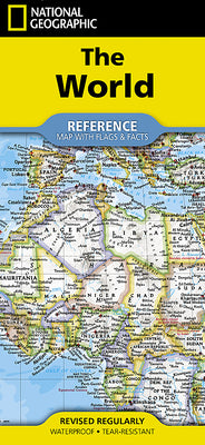
National Geographic World Classic Map (Folded with Flags and Facts)

- Waterproof - Tear-Resistant - Reference Map with Flags & Facts.

Regular price $14.98 USD
Regular price $27.24 USD Sale price $14.98 USD
Save 45%

Other New

Delivery to your door
In stock·Dispatches in 1–2 business days Non-book item
Ground shipping* from $8.40
Ground shipping transit* 3–6 business days after dispatch

Economy Mail is not available for this non-book item; ground or parcel shipping applies.

Faster options are available.

Rates and delivery estimates depend on your destination and item quantity. Estimates are informational only; the final shipping method and rate are selected at checkout.

Secure checkout
American Express Apple Pay DiscoverGoogle Pay Mastercard PayPalVisa
30-day eligible returns Returns & refunds policy

Book overview

- Waterproof - Tear-Resistant - Reference Map with Flags & Facts

Expertly researched and designed, National Geographic's World with Flags & Facts Map is the authoritative map of the world by which other reference maps are measured. The folded world map is designed for travel and durability.

  • Signature Classic style map with bright, easy to read color palette with blue oceans and colorful borders
  • Background shows mountain ranges and valleys in subtle shaded relief with mountain ranges labeled
  • Major water bodies including rivers, lakes, glaciers, oceans, seas, gulfs, bays, straits, and bathymetry
  • Clearly defined international boundaries, cities, islands, airports, and physical features
  • Thousands of place names carefully and artfully placed to maintain legibility in heavily populated areas
  • Up-to-date international boundaries and territorial control reflect de facto status on the ground
  • Meticulously researched using multiple authoritative sources including the U.N., U.S. Board on Geographic Names, and policies of individual governments.
  • Accurate place names use a combination of conventional English names, official national names, and standard transliterations for non-Latin alphabets.
  • Drawn in Winkel Tripel projection with distortions minimized unlike other World maps (e.g. Greenland is shown the same size as Argentina, not South America)
  • Corner inset maps feature vegetation, land use, population density, and north and south polar regions
  • National facts and flags with each country's area, population, capital city, GDP per capita, and flag

The map is printed in the USA on durable waterproof, tear-resistant synthetic paper to withstand repeated folding.

  • Map Scale = 1:37,213,000
  • Sheet Size = 37.75" x 25.5"
  • Folded Size = 4.25" x 9.25"
Shipping & returnsShipping options, delivery timing, and our return policy.

In-stock items normally dispatch within 1–2 business days. The ZIP-code estimator on this page is informational only; the final shipping method, price, and availability are confirmed at checkout for your full order.

For the initial delivery estimate we use these transit windows after dispatch: Standard 5–8 business days, Expedited 2–4 business days, and Priority 1–2 business days. Holiday delays are not included.

Eligible items can be returned within 30 days in accordance with our return policy.

Customer reviews

M
AlbakiReads
Malaika Taylor

I highly recommend to for anyone looking for inner clarity

T
AlbakiReads
Thomas DiMassa

Great service and fast service

Great shopping experience! The book arrived quickly, was well packaged, and matched the description perfectly. I would definitely shop with you again

O
AlbakiReads
Olivia

Smooth.