Home › Contact, European Invasion & Exploration › Cartographic Poetry

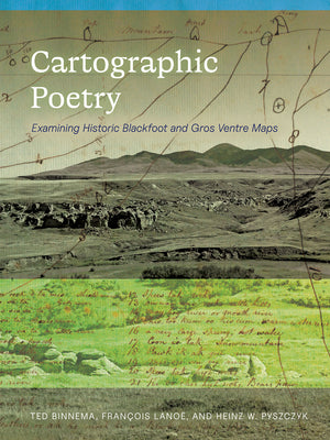
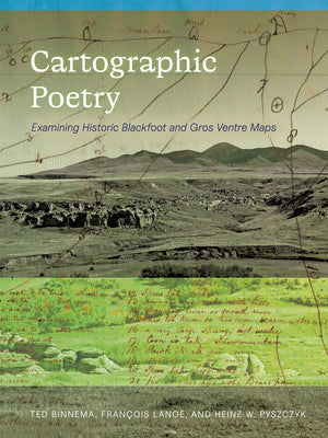
Cartographic Poetry

by Ted Binnema

Reading Blackfoot maps as records of place and territory

Regular price $39.36 USD
Regular price $49.20 USD Sale price $39.36 USD
Save 20%

Paperback New

Delivery to your door
In stock·Dispatches in 1–2 business days
Standard shipping* from $4.35
Standard shipping transit* 5–8 business days after dispatch

Faster options are available.

Rates and delivery estimates depend on your destination and item quantity. Estimates are informational only; the final shipping method and rate are selected at checkout.

Secure checkout
American Express Apple Pay DiscoverGoogle Pay Mastercard PayPalVisa
30-day eligible returns Returns & refunds policy

AlbakiReads Editorial

Reading Blackfoot maps as records of place and territory

Ted Binnema’s study examines five maps made in 1801 and 1802 by Blackfoot and Gros Ventre mapmakers for the Hudson’s Bay Company. The maps served as navigational tools, while also preserving evidence of places and historic Blackfoot perspectives on territory. Bringing historical, linguistic, and archaeological perspectives to these documents, the book considers what their mapped landforms and locations convey beyond practical wayfinding. Its subject connects early Indigenous mapmaking with the interpretation of landscape and the history of the North American prairies and foothills.

Good fit for readers who enjoy

  • Readers interested in Indigenous history and early mapmaking
  • Those studying Blackfoot territories and the history of the North American prairies and foothills
  • Readers seeking multidisciplinary approaches to historical documents

Themes

Indigenous cartographyBlackfoot territory and placeLandscape and wayfindingHistorical, linguistic, and archaeological interpretation

Based on publisher information and book metadata.

Book overview

"Poetry is language condensed; Blackfoot cartography is landscape distilled."


Cartographic Poetry is the first book-length, multidisciplinary study of five maps drawn in 1801 and 1802 by several Blackfoot and Gros Ventre people for the Hudson's Bay Company. Representing some of the oldest documents created by Indigenous people on the North American prairies and foothills, these maps preserve invaluable evidence about places on the landscape, and about historic Blackfoot views of their territories. The maps were intended as navigational tools, but the landforms and locations on the maps hold significance for the Blackfoot well beyond wayfinding, and have for many centuries. Exploring their content and utility from historical, linguistic, and archaeological perspectives, Ted Binnema, Fran

Shipping & returnsShipping options, delivery timing, and our return policy.

In-stock items normally dispatch within 1–2 business days. The ZIP-code estimator on this page is informational only; the final shipping method, price, and availability are confirmed at checkout for your full order.

For the initial delivery estimate we use these transit windows after dispatch: Standard 5–8 business days, Expedited 2–4 business days, and Priority 1–2 business days. Holiday delays are not included.

Eligible items can be returned within 30 days in accordance with our return policy.

Customer reviews

M
AlbakiReads
Malaika Taylor

I highly recommend to for anyone looking for inner clarity

T
AlbakiReads
Thomas DiMassa

Great service and fast service

Great shopping experience! The book arrived quickly, was well packaged, and matched the description perfectly. I would definitely shop with you again

O
AlbakiReads
Olivia

Smooth.