Home › History › OMAN's ATLAS OF THE PENINSULAR WAR: A Complete Colour Assembly of all Maps & Plans from Sir Charles Oman's History of the Peninsular War

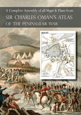
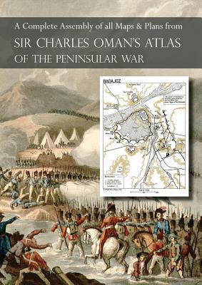
OMAN's ATLAS OF THE PENINSULAR WAR: A Complete Colour Assembly of all Maps & Plans from Sir Charles Oman's History of the Peninsular War

by Charles Oman

The Peninsular War in maps and plans

Regular price $30.91 USD
Regular price $38.64 USD Sale price $30.91 USD
Save 20%

Paperback New

Delivery to your door
In stock·Dispatches in 1–2 business days
Standard shipping* from $4.35
Standard shipping transit* 5–8 business days after dispatch

Faster options are available.

Rates and delivery estimates depend on your destination and item quantity. Estimates are informational only; the final shipping method and rate are selected at checkout.

Secure checkout
American Express Apple Pay DiscoverGoogle Pay Mastercard PayPalVisa
30-day eligible returns Returns & refunds policy

AlbakiReads Editorial

The Peninsular War in maps and plans

This atlas assembles maps and plans drawn from Charles Oman’s multi-volume history of the Peninsular War. Its contents range from regional views of Spain and Portugal to detailed plans of battles, sieges, campaigns, roads and terrain. The listed material covers events from 1808 onward, including Saragossa, Talavera, Bussaco and the Lines of Torres Vedras, with maps grouped by the volumes of Oman’s history. The emphasis is spatial: the atlas provides a way to consult the geography and military operations represented across that work, rather than a continuous narrative of the conflict.

Good fit for readers who enjoy

  • Readers consulting Oman’s history who want its maps and plans gathered in one volume.
  • Those researching the military geography and campaigns of the Peninsular War.
  • Collectors of illustrated reference material on the Napoleonic Wars.

Themes

Peninsular WarMilitary campaigns and battlesHistorical maps and plansSpain and Portugal

Based on publisher information and book metadata.

Book overview

THE FULL ROLL CALL OF MAPS AND PLANS INCLUDED IN THIS ATLAS ARE: Maps from Volume 1 1. Saragossa. 2. Battle of Medina de Rio Seco. July 14, 1808. 3. Battle of Baylen. July 19, 1818 at the moment of Dupont's third attack. Part of Andalusia, between Andujar and the Passes. July 19, 1808. 4. Battle of Vimiero. August 21, 1808. 5. Catalonia. 6. Part of Northern Spain. 7. Battle of Espinosa. November 11, 1808. Madrid in 1808. Battle of Tudela. November 23, 1808. 8. Battle of Corunna. January 16, 1809. 9. Large Map of Spain and Portugal, showing physical features and roads. Maps from Volume 2 10. Battle of Ucles. January 13, 1809. Siege of Rosas. November 6 to December 5, 1809. 11. Part of Catalonia, to illustrate St. Cyr's Campaign. November 1808 to March 1809. Battle of Valls. February 25, 1809. 12. Second Siege of Saragossa. December 1808 to February 1809. 13. Battle of Medellin. March 28, 1809. 14. Combat of Braga (Lanhozo). March 20, 1809. Oporto. March - May 1809, showing the Portuguese lines. 15. Northern Portugal, to illustrate Marshal Soult's Campaign of March to May 1809. 16. Battle of Alcaniz. May 23, 1809. Battle of Maria. June 15, 1809. 17. Battle of Talavera. The Main Engagement. 3 to 5pm, July 28, 1809. 18. Central Spain, showing the localities of the Talavera Campaign. July to August 1809. Maps from Volume 3 19. Siege of Gerona 20. Battle of Tamames. October 18, 1809. 21. Battle of Ocana. November 19, 1809. 22. Andalusia, to illustrate the Campaign of 1810. 23. Topography of Cadiz and its environs. 24. Central Portugal. 25. Siege of Astorga. 26. Siege of Ciudad Rodrigo. 27. Combat of the Coa. July 24, 1810. 28. General Map of Catalonia. 29. The Mondego Valley. 30. Battle of Bussaco. September 27, 1810. 31. Ney's attack at Bussaco. 32. Reynier's attack at Bussaco. 33. The Lines of Torres Vedras. Maps from Volume 4 34. Badajoz (the French Siege, January to March 1811), and the Battle of the Gebora (February 19, 1811). 35. The Battle of Barrosa. 36. General Map of the Barrosa Campaign. 37. Combat of Redinha 38. Combat of Casal Novo 39. Combat of Foz d'Arouce 40. The Lower Mondego. To illustrate the first Siege of Massena's Retreat. Leiria to the Alva River 41. Combat of Sabugal 42. Map to illustrate the last stage of Massena's Retreat and the Campaign of Fuentes de O
Shipping & returnsShipping options, delivery timing, and our return policy.

In-stock items normally dispatch within 1–2 business days. The ZIP-code estimator on this page is informational only; the final shipping method, price, and availability are confirmed at checkout for your full order.

For the initial delivery estimate we use these transit windows after dispatch: Standard 5–8 business days, Expedited 2–4 business days, and Priority 1–2 business days. Holiday delays are not included.

Eligible items can be returned within 30 days in accordance with our return policy.

Customer reviews